User:Jules/graduationproposal
~(^=^~)
Introduction
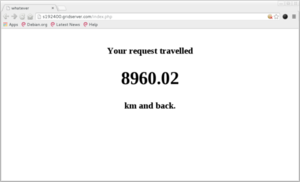
Using Ip addresses related to the hosting of online content. Plotting them to draw shapes over world map. Instead of doing a
Relation to previous practice
My previous practice is articulated around the process of mapping space and questioning the ways of creating such visualisations but also how they can determine our relationship to our close and distant environment.
Browsed landscapes consists in a series of three projects like variations of the same process The different applications of the same operation can generate different highlights over the question of the place when it comes to the Internet's infrastructure outputs. The investigation was pursued over the Network with the tools I could find.
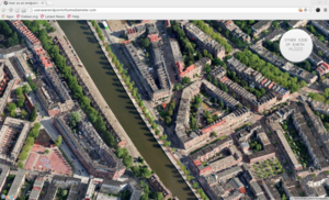
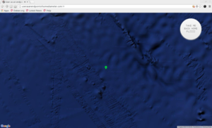
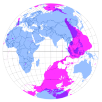
With userasanenpointofsomediameter, I geolocated the user's position on Google maps and took him through a “fake tunnel” that would lead them to the antipodes of their position. Although the title suggests the World as a spherical geometrical shape, the whole process deploys itself over the flat surface of the screen. This paradox is also present within the tool used, the ubiquitous interface of Google maps is presenting to us a flattened vision of the world.
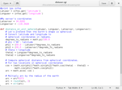
Nevertheless, within the API, I used the formula enabling to find a diameter's endpoint, in relation to any point over a circle's circumference.
var antipodes_lat = currentLatLng.lat() * -1;
var antipodes_lng = currentLatLng.lng() + 180;
Context
Thesis intention
Practical steps
Making practical sketching experiments
References
- Simulacra and simulation, 1994, Baudrillard
Today abstraction is no longer that of the map, the double, the mirror, or the concept. Simulation is no longer that of a territory, a referential being or substance. It is the generation by models of a real without origin or reality: A hyperreal. The territory no longer precedes the map, nor does it survive it. It is nevertheless the map that precedes the territory - precession of simulacra - that engenders the territory.
- Steps to an ecology of the mind, 1972 Gregory Bateson:
We say the map is different from the territory. But what is the territory? Operationally, somebody went out with a retina or a measuring stick and made representations which were then put on paper. What is on the paper map is a representation of what was in the retinal representation of the man who made the map; and as you push the question back, what you find is an infinite regress, an infinite series of maps. The territory never gets in at all. The territory is Ding an sich and you can't do anything with it. Always, the process of representation will filter it out so that the mental world is only maps of maps, ad infinitum.
- Flat Earth Society
- From Psychogeography to Cybertopology; 2006, Sher Doruff
(dis)Orienting Place : Performing “ place” through purposeful disorientation was the aesthetic of early Situationist dérives. Today the technological accoutrement for triangulated, coordinate spe-cific, Cartesian orientation is apparent in many current locative projects. Aesthetic practice accessed through a network of military satellites has détourned the dérive signifi-cantly. The shapeshift between discipline and control, between game and play, is felt in the relation between orientation and disorientation.
- Smooth and striated space, 1972, A thousand plateaux
- Entropy made visible, 1973, Robert Smithson
De-architecture : Architects never seem to allow for any kind of relationship outside their own plans, same with economics. They expect to be isolated and self-contained, conceived as cycles to exclude the entropic process.
- Martin Dodge, 2008
- GPS Errors and Pilgrimage to Lourde, 2010, Benjamin Mako Hill
http://revealingerrors.com/lourdes_gps
———??? “Architecture is an art of distinctions within the continuum of space.” (W.J. Mitchell, The Logic of Architecture, p.1)

