User:Lor.ensō/thesis-outline: Difference between revisions
No edit summary |
|||
| Line 80: | Line 80: | ||
'''''how to develop a counter-mapping practice in relation to he issue of accessibility in Rotterdam''''' | '''''how to develop a counter-mapping practice in relation to he issue of accessibility in Rotterdam''''' | ||
| Line 88: | Line 85: | ||
'''''infrastructure for countermapping / anti-campaigning by showing (human) complications''''' | '''''infrastructure for countermapping / anti-campaigning by showing (human) complications''''' | ||
==== 1. Innovation and Virtual Tools as development or demolition of reality ==== | ==== 1. Virtually - Architecturally / Innovation and Virtual Tools as development or demolition of reality ==== | ||
==== 2. | ==== 2. Bureaucratically - Culturally / zoning: friction between counter culture and bureaucracy, false iconism vs community ==== | ||
==== 3. | ==== 3. Socially - Accessibily / (un)Familiar barriers, social thresholds and unmeant ignorance ==== | ||
Revision as of 10:46, 22 November 2024
What do you **WANT** to write? [What will the text be about? (thesis). What do you want to explore? Be clear about HOW you want to tell your story.
I want to write: to reflect, (de)construct, criticize Rotterdam. I want to use my knowledge / experience in world building, working with 3D software and reflecting on these environments in relation to the utopian postcard realities that I see in the city and with my gained knowledge in dealing with multiple facets of living in Rotterdam.
THRESHOLD, THE TILE AND THE CUBE
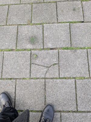
To shape my thesis, I want to use the tile as a metaphor. A tile is generally fixed in place in an array to cover. In this thesis I want to uncover the tiles.
Beginning from the personal small tile of context that includes reality.
I order to reflect / criticize the city, I want to start at the first tile and then zooming out towards 'the big picture'
Since most(if not all) modern (atro)cities seem to be in developed in 3D software, I'm starting to think the implementation of virtual reality renders the street into a design instead of the other way around.
In this Thesis, it would a great (visual) exploration to go through positive and negative renders of the visual representation and putting these next to the contexts of a city.
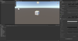
A 3D workspace looks like a grey void. Since this representation feels hollow, I want to reflect on the 3D cube and artificial renders.
To prevent confusion or overstimulation, I want use a frame, a tile. The tile as a small square, a frame, a window, a screen, aface.
Since a cube has 6 tiles, the format will be 6 chapters or at least will dice around 6 elements.
And to look at the municipality / government / designers and their tools that either help improve or demolish through city marketing/planning. This informational / imagery journey could be building blocks of critique on order to actually help and build a better city: not only through but also from A(accessibility/disability), I want to write about the tools I have used and linking these tools to how they shape reality. The tools I'm thinking of are my previous media of 3D softwares:Ways to make scenes and worlds based on the institutional cFilling the grey void with complexity through contexturesritiques I wanted to discuss during my Bachelors.
Contextures / Chapters
Socially - Personal, Affordable, Family, Housing

Accessibly - Disability, Information provision, infrastructures

Bureaucratically - Protocols of local municipal / governments

Architecturally - Buildings, ways, pavements, roads, streets

Virtually - Imagery, impression, media, softwares, simulation, games

Culturally - budget cuts, false iconism, counterculture, grassroots, community, festivals/gigs/events
These six are connected in my countercube with contextures: A drawing per chapter to alternative looks to postcard utopianism.
Contextures are context-textures which are based on finding miscalculations. ( countermap. )
It is crucial to mention that I will not allow myself to fall in a pit of despair but to healthily reflect on the topics, not having an answer but reacting honestly within the complex matters and also to look at the alternatives.
I want to reflect on these tools and how they are used. Especially because I start to see this kind of image in multiple parts of Rotterdam. I'm starting to see the resemblance with certain (dystopic) virtual representations in games like Cyberpunk 2077, next to that, I'm currently diving into the idea of the city as machine / medium and other metaphors to help shape my critiques.
Since most(if not all) modern cities are in development in 3D software, I'm starting to think the implementation of virtual reality renders the street into a design instead of the other way around. In this Thesis, it would a great (visual) exploration to go through positive and negative renders of the visual representation and putting these next to the contexts of a city. And to look at the municipality / government / designers and their tools that either help improve or demolish through city marketing/planning. This informational / imagery journey could be building blocks of critique on order to actually help and build a better city: not only through X(width), Y(height), Z(depth) and T(time) but also from A(accessibility/disability), L(livability, housing, affordability), C(culturability, festivals/gigs/events).
These are all dimensions that have context in contrast to the (pre)calculated 3D area of X(width), Y(height), Z(depth) and T(time).
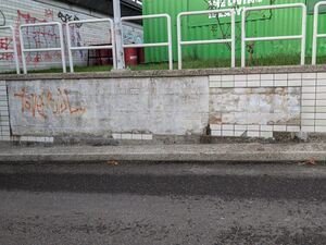
The utopian postcards of a new apartment building and the promise of new icons are ideal landscapes made from artist/artificial impressions.
Using drawings as an alternative to the hollow representation that seem to 'shape' Rotterdam.
how to develop a counter-mapping practice in relation to he issue of accessibility in Rotterdam
infrastructure for countermapping / anti-campaigning by showing (human) complications
1. Virtually - Architecturally / Innovation and Virtual Tools as development or demolition of reality
2. Bureaucratically - Culturally / zoning: friction between counter culture and bureaucracy, false iconism vs community
3. Socially - Accessibily / (un)Familiar barriers, social thresholds and unmeant ignorance
References
3D CONTINUUM
https://volumetricregimes.xyz/index.php?title=The_Industrial_Continuum_of_3Dhttps://monoskop.org/images/0/04/Kittler_Friedrich_1996_The_City_Is_a_Medium.pdf
https://placesjournal.org/article/a-city-is-not-a-computer/
https://salvage.zone/salvaging-situationism-race-and-space/
Rene Boer - Smooth City
LASSE VAN DEN BOSCH CHRISTENSEN - I, FOR ONE, WELCOME OUR NEW OVERLORDS
additions±
CANVAS WAN - Into the digital void
JESSE SIEGEL - DEFAULT ALPHA
Mariken OVerdijk / The city as anthology: movements at the margins of public space
How Not To Be Seen
https://www.notbored.org/UU.html
FLANEUR CRITICISM [https://salvage.zone/salvaging-situationism-race-and-space/](https://salvage.zone/salvaging-situationism-race-and-space/)
VERS BETON


