User:Zpalomagar/RESEARCH: Difference between revisions
Zpalomagar (talk | contribs) |
Zpalomagar (talk | contribs) No edit summary |
||
| Line 1: | Line 1: | ||
==PROJECT REFERENCES== | ==PROJECT REFERENCES== | ||
===Coming Home - Margaret Pearce=== | |||
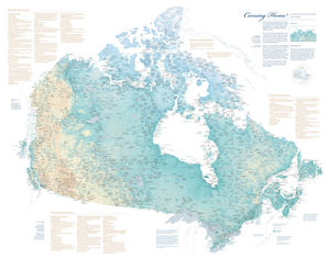
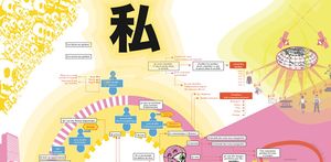
To mark the 150th anniversary of the Confederation of Canada, the Canadian-American Center at the University of Maine is pleased to release a new map, Coming Home to Indigenous Place Names in Canada. The map honors Indigenous place names in Canada and the assertion of Indigenous authority through place names. | |||
Commissioned by Dr. Stephen J. Hornsby, Director of the Canadian-American Center, Coming Home to Indigenous Place Names in Canada was researched and designed by Dr. Margaret Wickens Pearce. The map depicts Indigenous place names across Canada, shared by permission of First Nations, Métis, and Inuit communities and people. The names express territorial rights and describe the shapes, sounds, and stories of sovereign lands. The names mark the locations of the gathering places, the communities, the places of danger and beauty, and the places where treaties were signed. The names are ancient and recent, both in and outside of time, and they express and assert the Indigenous presence across the Canadian landscape in Indigenous languages. | |||
The map does not depict all of the Indigenous place names of Canada, nor are all Indigenous Nations and communities represented. Beyond the map’s names are thousands upon thousands more, an ever growing and expanding atlas of intimate, geographical knowledge and experience. | |||
The intention of the map is to create respect for Indigenous homelands and sovereignties, and a feeling for and understanding of the place names. | |||
The Canadian-American Center does not profit from the production and sale of this map. Members of the public are invited to purchase a copy for the cost of printing and postage. Contributors of place names to the map are invited to email the Canadian-American Center for a discounted rate. | |||
[[File:Coming_home.jpg|thumbnail|300px|center|Coming Home Indigenous Map]] | |||
===Imaging Homelessness in a City of Care=== | ===Imaging Homelessness in a City of Care=== | ||
Revision as of 09:49, 30 September 2019
PROJECT REFERENCES
Coming Home - Margaret Pearce
To mark the 150th anniversary of the Confederation of Canada, the Canadian-American Center at the University of Maine is pleased to release a new map, Coming Home to Indigenous Place Names in Canada. The map honors Indigenous place names in Canada and the assertion of Indigenous authority through place names.
Commissioned by Dr. Stephen J. Hornsby, Director of the Canadian-American Center, Coming Home to Indigenous Place Names in Canada was researched and designed by Dr. Margaret Wickens Pearce. The map depicts Indigenous place names across Canada, shared by permission of First Nations, Métis, and Inuit communities and people. The names express territorial rights and describe the shapes, sounds, and stories of sovereign lands. The names mark the locations of the gathering places, the communities, the places of danger and beauty, and the places where treaties were signed. The names are ancient and recent, both in and outside of time, and they express and assert the Indigenous presence across the Canadian landscape in Indigenous languages.
The map does not depict all of the Indigenous place names of Canada, nor are all Indigenous Nations and communities represented. Beyond the map’s names are thousands upon thousands more, an ever growing and expanding atlas of intimate, geographical knowledge and experience.
The intention of the map is to create respect for Indigenous homelands and sovereignties, and a feeling for and understanding of the place names.
The Canadian-American Center does not profit from the production and sale of this map. Members of the public are invited to purchase a copy for the cost of printing and postage. Contributors of place names to the map are invited to email the Canadian-American Center for a discounted rate.
Imaging Homelessness in a City of Care
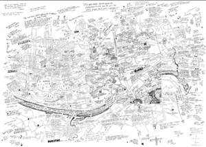
Imaging Homelessness in a City of Care was a participatory mapping project undertaken with 30 single homeless people in Newcastle-upon-Tyne (UK) in 2014. The project’s objectives were threefold: to pilot an innovative mapping-based methodology; to offer single homeless individuals an opportunity to comment on local service provision and delivery; and to inform and challenge public perceptions of homelessness. In what follows, we outline the context for the project and the reasons for adopting a mapping approach. We then discuss the research process and the various insights generated. Finally, we reflect on the effectiveness of the methodology used.

