User:Zpalomagar/RESEARCH: Difference between revisions
Zpalomagar (talk | contribs) No edit summary |
Zpalomagar (talk | contribs) |
||
| (33 intermediate revisions by the same user not shown) | |||
| Line 69: | Line 69: | ||
PIMGGALLERY001.jpg | PIMGGALLERY001.jpg | ||
PIMGGALLERY002.jpg | PIMGGALLERY002.jpg | ||
Steinberg_New_Yorker_Cover.png | |||
counter-cartographies_900X600.jpg | |||
surrealistworldmap1929.png | |||
carroll-map.jpg | |||
psychogeographicmap.jpg | |||
</gallery> | </gallery> | ||
==SOME MORE MAPS== | |||
[http://www.landmarkmap.org/map/#x=-102.46&y=13.47&l=3&a=community_FormalDoc%2Ccommunity_NoDoc%2Ccommunity_FormalClaim%2Ccommunity_Occupied%2Cindigenous_FormalDoc%2Cindigenous_NoDoc%2Cindigenous_FormalClaim%2Cindigenous_Occupied LandMarkMap]<br> | |||
[https://architectse17.wordpress.com/where-in-wally/ WHERE IN WALLY]<br> | |||
[https://mapkibera.org MAP KIBERA] | |||
[https://maps.squat.net/en/cities/rotterdam/squats# Squat Maps] | |||
==TO WORK WITH??== | |||
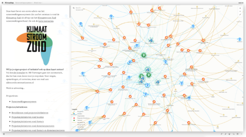
===Making Community Sense=== | |||
Aldo de Moor<br> | |||
They use the tool Kumu <br> | |||
[https://makingcommunitysense.net MAKING COMMUNITY SENSE] | |||
[[File:p_communitysense.png|thumbnail|500px|center|Making community sense collective map]] | |||
===UrbanA & Drift=== | |||
New platform created for a justice urban design. They work with Drift which is a collective group of researchers in Erasmus University for social sustainable development. | |||
Based in Rotterdam-Barcelona-Berlin and Brussels<br /> | |||
[https://urban-arena.eu/arenas/ urbanA] | |||
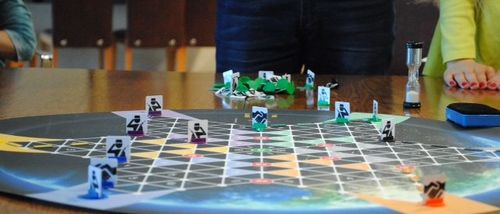
===Human Security Collective=== | |||
Human Security Collective (HSC) is a foundation based in The Hague working on issues of development, security and the involvement of citizens in their communities and societies. We believe that the idea of Human Security with its focus on people, relationships and human rights provides an organizing frame for action.<br /> | |||
[[File:p_hmansecuritycollective.jpg|thumbnail|500px|center|Collective Workshop game session]] | |||
== | [https://www.hscollective.org Human Security Collective Website] | ||
[ | |||
===AIR - Architecture Institution Rotterdam=== | |||
[https://www.airrotterdam.eu/ AIR] | |||
===DATACTIVE=== | |||
The politics of data according to civil society.<br> | |||
We are DATACTIVE, a research project and a research collective exploring the politics of big data broadly defined. We take a critical look at massive data collection, privacy and surveillance | social movements, activism and internet activism | internet infrastructure, cybersecurity and their governance | open data and civic tech networks. The Department of Media Studies and the Amsterdam School of Cultural Analysis at the University of Amsterdam are our nests.<br> | |||
[https://data-activism.net DATACTIVE] | |||
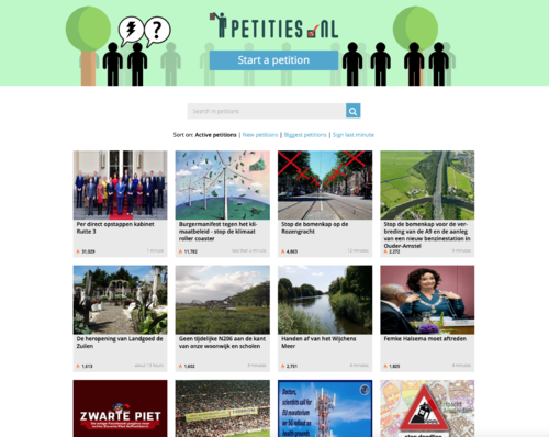
===Petitions platforms=== | |||
[https://www.gopetition.com/search/results?keyword=&category=®ion=149&type=petitions Geopetition] | |||
[https://petities.nl/?locale=en Petities] | |||
[[File:p_petitions.png|thumbnail|500px|center|Petitions platform interface]] | |||
===Placemarkers=== | |||
Placemakers (re)develops public spaces together with the neighborhood. Our projects contain elements of research, design and programming of public space with local stakeholders, as well as public participation and process management. <br> | |||
[https://placemakers.nl/en/projects/ Place Markers] | |||
===Missing Maps=== | |||
Putting the World’s vulnerable people on the map.They act globally, not only in The Netherlands<br> | |||
Missing Maps is an open, collaborative project in which you can help to map areas where humanitarian organisations are trying to meet the needs of vulnerable people. <br> | |||
[https://www.missingmaps.org Missing maps] | |||
===Poortgebouw=== | |||
https://poortgebouw.org | |||
Latest revision as of 14:27, 20 November 2019
PROJECT REFERENCES
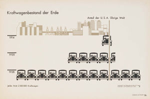
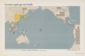
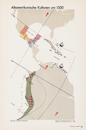
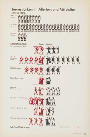
Atlas Gesellschaft u Wirtschaft - Otto Neurath
Commissioned by the Bibliographisches Institut in Leipzig, the atlas Gesellschaft und Wirtschaft is one of the best-known examples of Otto Neurath’s “Viennese method of pictorial statistics” (at the time it wasn’t yet called ISOTYPE) in action. It was published as a large-format (30×45 cm) folder containing 130 plates, 98 of which display maps and charts relating to topics such as history, migrations, economics, urbanism, etc. A complete PDF version of Gesellschaft und Wirtschaft can be downloaded for free here.
The maps and charts were originally hand-crafted by the staff from the Gesellschafts- und Wirtschaftsmuseum in Wien (Social and economic museum of Vienna), whose core team included Neurath, “transformer” Marie Reidemeister (later Marie Neurath) and graphic designer Gerd Arntz. Futura, which had been adopted by the Museum for all its printed matter some time in 1929, was used for titles, captions, numbers, etc., but the 30 plates of end matter (afterword by Neurath, statistical sources, index, contents) were typeset in Berthold-Grotesk (bottom picture).
The last couple of years have seen a steady stream of publications devoted to Neurath, his method and his work, most notably Isotype: design and contexts, 1925–1971, edited by Christopher Burke, Eric Kindel and Sue Walker. Though more modest in scope, Robin Kinross and Marie Neurath’s The transformer: principles of making Isotype charts is also a treat.
Ni por todo el oro del mundo! - Iconoclasistas
Los mapeos se realizaron en Jujuy y Córdoba, como parte de las actividades de la Unión de asambleas ciudadanas (UAC); y en Buenos Aires, Bariloche, Tucumán, El Dorado (Misiones) y en Ciudad del Este (Paraguay), a partir de la convocatoria del equipo de pedagogía popular Pañuelos en Rebeldía. También en mapeos que organizamos durante la «gira de la cosmovisión rebelde», años 2008-2009, con movimientos estudiantiles y culturales en Córdoba, Rosario, Resistencia, Mar del Plata, Olavarría, Tandil y San Andrés de Giles. En esos espacios no sólo se compartió saberes e información, sino que también se fue corrigiendo lo sistematizado, fortaleciendo así el desarrollo de un trabajo en etapas. Un momento crítico se generó cuando a los participantes les planteamos lo siguiente: teniendo en cuenta que diseñaríamos mapas de circulación pública ¿deberíamos mostrar también las resistencias y logros de las organizaciones? Este dilema se resolvió de forma positiva en un segundo encuentro de la UAC en Córdoba, cuando decenas de delegados de asambleas y comunidades votaron a mano alzada la importancia de visibilizar las resistencias y organizaciones en lucha.
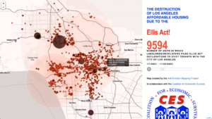
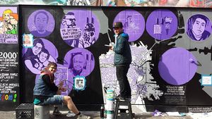
Anti Eviction Maps
The Anti-Eviction Mapping Project is a data-visualization, data analysis, and storytelling collective documenting the dispossession and resistance upon gentrifying landscapes. Primarily working in the San Francisco Bay Area, Los Angeles, and New York City, we are all volunteers producing digital maps, oral history work, film, murals, and community events. Working with a number of community partners and in solidarity with numerous housing movements, we study and visualize new entanglements of global capital, real estate, technocapitalism, and political economy. Our narrative oral history and video work centers the displacement of people and complex social worlds, but also modes of resistance. Maintaining antiracist and feminist analyses as well as decolonial methodology, the project creates tools and disseminates data contributing to collective resistance and movement building.
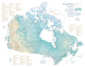
Coming Home - Margaret Pearce
To mark the 150th anniversary of the Confederation of Canada, the Canadian-American Center at the University of Maine is pleased to release a new map, Coming Home to Indigenous Place Names in Canada. The map honors Indigenous place names in Canada and the assertion of Indigenous authority through place names.
Commissioned by Dr. Stephen J. Hornsby, Director of the Canadian-American Center, Coming Home to Indigenous Place Names in Canada was researched and designed by Dr. Margaret Wickens Pearce. The map depicts Indigenous place names across Canada, shared by permission of First Nations, Métis, and Inuit communities and people. The names express territorial rights and describe the shapes, sounds, and stories of sovereign lands. The names mark the locations of the gathering places, the communities, the places of danger and beauty, and the places where treaties were signed. The names are ancient and recent, both in and outside of time, and they express and assert the Indigenous presence across the Canadian landscape in Indigenous languages.
The map does not depict all of the Indigenous place names of Canada, nor are all Indigenous Nations and communities represented. Beyond the map’s names are thousands upon thousands more, an ever growing and expanding atlas of intimate, geographical knowledge and experience.
The intention of the map is to create respect for Indigenous homelands and sovereignties, and a feeling for and understanding of the place names.
The Canadian-American Center does not profit from the production and sale of this map. Members of the public are invited to purchase a copy for the cost of printing and postage. Contributors of place names to the map are invited to email the Canadian-American Center for a discounted rate.
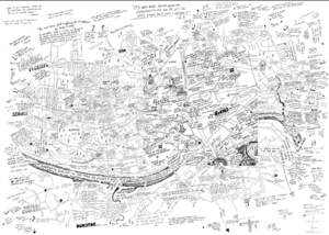
Imaging Homelessness in a City of Care
Imaging Homelessness in a City of Care was a participatory mapping project undertaken with 30 single homeless people in Newcastle-upon-Tyne (UK) in 2014. The project’s objectives were threefold: to pilot an innovative mapping-based methodology; to offer single homeless individuals an opportunity to comment on local service provision and delivery; and to inform and challenge public perceptions of homelessness. In what follows, we outline the context for the project and the reasons for adopting a mapping approach. We then discuss the research process and the various insights generated. Finally, we reflect on the effectiveness of the methodology used.
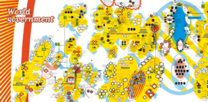
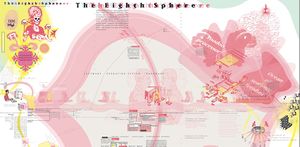
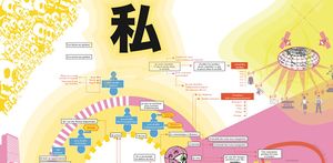
Bureau d'études
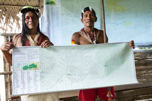
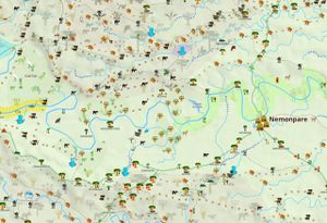
Waorani Map
IMG COLLECTION
SOME MORE MAPS
LandMarkMap
WHERE IN WALLY
MAP KIBERA
Squat Maps
TO WORK WITH??
Making Community Sense
Aldo de Moor
They use the tool Kumu
MAKING COMMUNITY SENSE
UrbanA & Drift
New platform created for a justice urban design. They work with Drift which is a collective group of researchers in Erasmus University for social sustainable development.
Based in Rotterdam-Barcelona-Berlin and Brussels
Human Security Collective
Human Security Collective (HSC) is a foundation based in The Hague working on issues of development, security and the involvement of citizens in their communities and societies. We believe that the idea of Human Security with its focus on people, relationships and human rights provides an organizing frame for action.
Human Security Collective Website
AIR - Architecture Institution Rotterdam
DATACTIVE
The politics of data according to civil society.
We are DATACTIVE, a research project and a research collective exploring the politics of big data broadly defined. We take a critical look at massive data collection, privacy and surveillance | social movements, activism and internet activism | internet infrastructure, cybersecurity and their governance | open data and civic tech networks. The Department of Media Studies and the Amsterdam School of Cultural Analysis at the University of Amsterdam are our nests.
DATACTIVE
Petitions platforms
Placemarkers
Placemakers (re)develops public spaces together with the neighborhood. Our projects contain elements of research, design and programming of public space with local stakeholders, as well as public participation and process management.
Place Markers
Missing Maps
Putting the World’s vulnerable people on the map.They act globally, not only in The Netherlands
Missing Maps is an open, collaborative project in which you can help to map areas where humanitarian organisations are trying to meet the needs of vulnerable people.
Missing maps
