User:Renee Oldemonnikhof/rotterdams shifting center: Difference between revisions
No edit summary |
No edit summary |
||
| Line 2: | Line 2: | ||
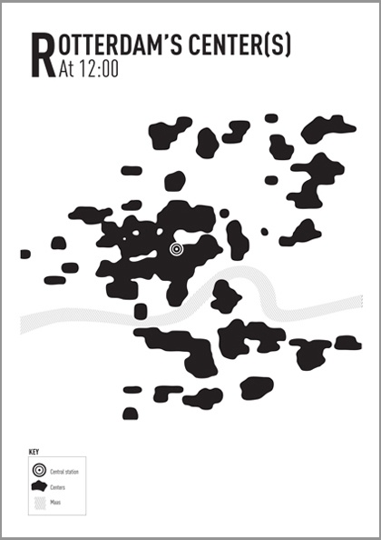
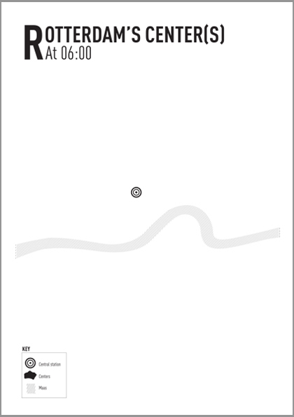
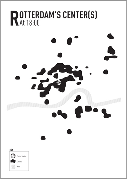
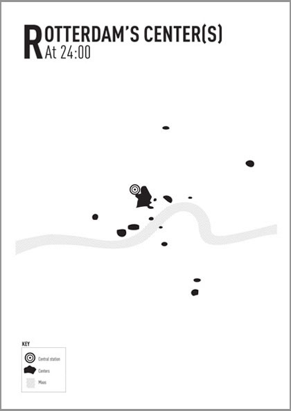
In this project i focused on the opening and closing times of all major chains within the city. In this way I at least had something solid and concrete to work with, and it would give me a good approximation to how, where and when it was shifting. I started of by compiling all major chain stores, pharmacies, bakeries, restaurants, cafes, clubs etc. and recording individually their opening and closing times on a regular Saturday. Then I looked up all the addresses and placed them onto a map, and then turned the stores on and off according to there opening and closing times. In this way I was able to get a moveable image that showed me exactly where and when the city sleeps and reawakes. | In this project i focused on the opening and closing times of all major chains within the city. In this way I at least had something solid and concrete to work with, and it would give me a good approximation to how, where and when it was shifting. I started of by compiling all major chain stores, pharmacies, bakeries, restaurants, cafes, clubs etc. and recording individually their opening and closing times on a regular Saturday. Then I looked up all the addresses and placed them onto a map, and then turned the stores on and off according to there opening and closing times. In this way I was able to get a moveable image that showed me exactly where and when the city sleeps and reawakes. | ||
[[File:1center.jpg]][[File:2center.jpg]][[File:3center.jpg]][[File:4center.jpg]] | |||
Revision as of 10:35, 16 March 2011
Rotterdams Shifting Center
In this project i focused on the opening and closing times of all major chains within the city. In this way I at least had something solid and concrete to work with, and it would give me a good approximation to how, where and when it was shifting. I started of by compiling all major chain stores, pharmacies, bakeries, restaurants, cafes, clubs etc. and recording individually their opening and closing times on a regular Saturday. Then I looked up all the addresses and placed them onto a map, and then turned the stores on and off according to there opening and closing times. In this way I was able to get a moveable image that showed me exactly where and when the city sleeps and reawakes.
